Hammerknuden

Hammerknuden
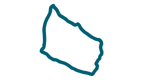
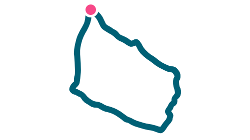
Hammerknuden – often called Hammeren – is one of Bornholm’s most unique and varied natural areas. Here, cliffs and sea meet in a landscape shaped by the forces of the Ice Age, and the area contains a rare concentration of nature types, cultural history and geology. The granite headland rises from the low skerry coast at Hammerodde and climbs to its highest point at 82 metres near Hammerfyr on Ørnebjerg, offering panoramic views in all directions.
Hammerknuden bears clear traces of glacial movement during the last Ice Age. The northeast side is smoothly rounded where the ice ground heavily against the rock, while the west side is dramatic with steep, rugged cliff faces shaped over centuries by the sea and weather. Throughout the area you can see glacial striations in the granite and small ridges that are flat to the northeast and sharply cut to the west. Opalsøen – a former granite quarry – stands as a reminder of the long period of stone cutting that once took place here.
The nature types on Hammerknuden are diverse: heathland on bare rock with heather, juniper and crowberry in the most exposed areas; moist heath in the lower parts; mixed forest; and fertile valleys. This great variety creates favourable conditions for rich plant and animal life within a relatively small area. Hammerknuden is separated from the rest of northern Bornholm by a deep fissure valley containing the island’s largest lake, Hammersø, along with Opalsøen and Krystalsøen, both remnants of former granite extraction.
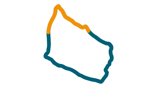
The area is ideal for hiking, and the approximately 7 km route Hammerknuden Rundt leads through some of Bornholm’s most characteristic landscapes: from skerry coast and bird cliffs at Hammerodde to steep rock faces at Hammerhavn and calm surroundings at the old quarry lakes. Along the way, you pass several notable cultural landmarks, including the medieval ruin of Salomons Chapel and the two lighthouses Hammerfyr and Hammerodde Fyr, which reflect the area’s historical importance for navigation.
Hammerknuden is one of the places on Bornholm where the island’s distinctive natural character is clearly expressed. Cliff formations, viewpoints, lakes, traces of cultural history and varied vegetation shape the area and give an impression of nature at its most distinctive and impressive.
Hammerknuden – often called Hammeren – is one of Bornholm’s most unique and varied natural areas. Here, cliffs and sea meet in a landscape shaped by the forces of the Ice Age, and the area contains a rare concentration of nature types, cultural history and geology. The granite headland rises from the low skerry coast at Hammerodde and climbs to its highest point at 82 metres near Hammerfyr on Ørnebjerg, offering panoramic views in all directions.
Hammerknuden bears clear traces of glacial movement during the last Ice Age. The northeast side is smoothly rounded where the ice ground heavily against the rock, while the west side is dramatic with steep, rugged cliff faces shaped over centuries by the sea and weather. Throughout the area you can see glacial striations in the granite and small ridges that are flat to the northeast and sharply cut to the west. Opalsøen – a former granite quarry – stands as a reminder of the long period of stone cutting that once took place here.
The nature types on Hammerknuden are diverse: heathland on bare rock with heather, juniper and crowberry in the most exposed areas; moist heath in the lower parts; mixed forest; and fertile valleys. This great variety creates favourable conditions for rich plant and animal life within a relatively small area. Hammerknuden is separated from the rest of northern Bornholm by a deep fissure valley containing the island’s largest lake, Hammersø, along with Opalsøen and Krystalsøen, both remnants of former granite extraction.
The area is ideal for hiking, and the approximately 7 km route Hammerknuden Rundt leads through some of Bornholm’s most characteristic landscapes: from skerry coast and bird cliffs at Hammerodde to steep rock faces at Hammerhavn and calm surroundings at the old quarry lakes. Along the way, you pass several notable cultural landmarks, including the medieval ruin of Salomons Chapel and the two lighthouses Hammerfyr and Hammerodde Fyr, which reflect the area’s historical importance for navigation.
Hammerknuden is one of the places on Bornholm where the island’s distinctive natural character is clearly expressed. Cliff formations, viewpoints, lakes, traces of cultural history and varied vegetation shape the area and give an impression of nature at its most distinctive and impressive.